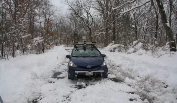
Researchers look under the road to aid self-driving cars
Car companies and researchers have been feverishly working to improve the technologies behind self-driving cars. But so far, even the most high-tech vehicles still fail when it comes to safely navigating in rain and snow.
That's because these weather conditions wreak havoc on the most common approaches for sensing, which usually involve either lidar sensors or cameras. In the snow, for example, cameras can no longer recognize lane markings and traffic signs, while the lasers of lidar sensors malfunction when rain, snow or sleet are flying down from the sky.
MIT researchers funded by the National Science Foundation wondered whether an entirely different approach might work. What if they instead looked under the road?
A team from MIT's Computer Science and Artificial Intelligence Lab (CSAIL) developed a new system that uses an existing technology called ground-penetrating radar (GPR) to send electromagnetic pulses underground that measure an area's specific combination of soil, rocks and roots. The mapping process creates a unique fingerprint the car can later use to localize itself when it returns to that plot of land. The CSAIL team used a form of GPR instrumentation called localizing ground-penetrating radar, or LGPR.
"If you or I grabbed a shovel and dug it into the ground, all we're going to see is a bunch of dirt," said CSAIL researcher Teddy Ort, lead author of a new paper about the project published in the IEEE Robotics and Automation Letters journal. "But LGPR can quantify the specific elements and compare them to the map it’s already created, so it knows exactly where it is, without needing cameras or lasers."
"Our work demonstrates that this approach is a practical way to help self-driving cars navigate in poor weather without needing to 'see' in the traditional sense using laser scanners or cameras," said Daniela Rus of MIT, senior author of the new paper.
"Ground penetrating radar data profiles are commonly used to identify the location and depth of buried objects," said Radhakisan Baheti, a program director in NSF's Directorate for Engineering. "The idea of using GPR for road mapping and navigation of autonomous vehicles is innovative and has the potential to impact in a major way the safety of autonomous vehicles in snow and ice."
