Mapping science: How GIS transformed our view of the world
An NSF investment 35 years ago helped chart the course for geographic information sciences — defining a field of study that crosses disciplinary boundaries and has the potential to shape society's approach to building a sustainable future.
It's a busy day anywhere in the world. You roll out of bed and grab your smartphone. You check a news website or a weather app or look up directions to an appointment. Most people don't think about it much, but those modern-day conveniences depend on spatial data — on maps that connect and overlay information about different aspects of the world.
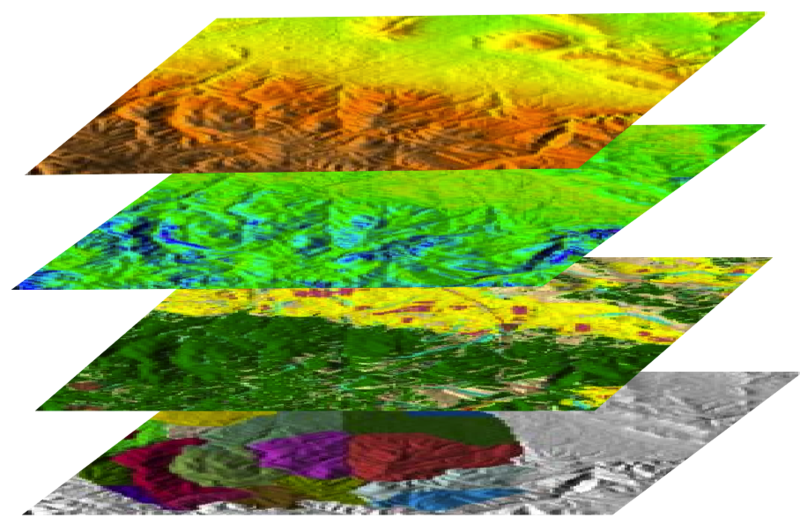
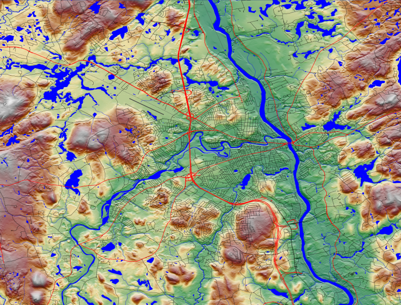
That spatial data is organized using geographic information systems (GIS), computer-based tools used to store, visualize, analyze and interpret geographic data. Information about roads, topography, weather conditions, landmarks, businesses and more are organized into layers that can be combined and displayed on maps.
The ubiquity of GIS today goes well beyond your smartphone to systems used by industry — for example, to ensure products and people get where they need to go — and to various scientific applications. It helps epidemiologists map the spread of disease, ecologists understand the movement of wildlife and climate scientists understand changes in glaciers, sea levels and regional weather patterns. Furthermore, GIS assists social scientists studying global conflict and immigration and urban planners and engineers determining the best places for new development and infrastructure.
How did our GIS-dependent world and GIS-related science evolve, and where did GIS come from? It turns out the U.S. National Science Foundation played a central role in the technology's development and growth. And that support continues today: In the last two years alone, NSF has awarded about 180 grants, totaling more than $83 million, to support research related to GIS — in fields ranging from geography to math, computer science, geology, anthropology and education.
From spatial data handling to geographic information science
When GIS was first developed in the 1950s and 60s, it was referred to as spatial data handling, reflecting the field's origin as a technical pursuit — using computers to manage, display and analyze spatial data.
In 1969, Jack Dangermond and his wife Laura started the Environmental Systems Research Institute, now known as Esri, to help clients use GIS for land-use and planning projects. Over time, that work transformed into a business selling the software that Esri had developed for those projects. "We started really with the idea of abstracting geographic information as layers, putting it into the computer," Jack Dangermond recalls "… we had to sort of make up aspects of what we were doing. We had to invent data models."
By the 80s, practitioners were debating whether GIS was more than just a map-making and analysis technology. In 1988, the National Center for Geographic Information and Analysis (NCGIA) was established as an NSF-funded consortium among the University of California, Santa Barbara; the University at Buffalo; and the University of Maine.
Over the following decade, NCGIA initiatives covered fundamental questions about spatial data, including its accuracy and representation. The program also delved into more technical questions related to using, managing and sharing large datasets and explored GIS applications for studying global change, law, social policy and more. In the midst of this flurry of research activity, the center developed the first core curriculum in GIS.
The research and curricular output of NCGIA helped elevate the study of geographic information systems into a science. "I argued that it would make a lot of sense to use the same acronym, GIS, but with a spectrum of meaning from 'S equals system' to 'S equals science,'" says Michael Goodchild, emeritus distinguished professor at UCSB and former longtime director of NCGIA. "It was a concerted effort to turn GIS into a recognized science."
A $28 billion industry
As the 1990s wound to a close, NCGIA's efforts had spun off into several related NSF-supported centers, including the Center for Spatially Integrated Social Science and the National Center for Ecological Analysis and Synthesis, both at USCB. The use of GIS in science had spread from geography to sociology and criminology and from geology to conservation science, ecology and engineering. Thanks in large part to NCGIA's core curriculum, GIS teaching had also spread.
Use of both open-source and proprietary software, like what Esri offers, has accelerated into what Dangermond estimates is a "$28 billion ecosystem of applications." The GIS Certification Institute estimated in 2020 that there were more than 675,000 people working as GIS professionals.
"The National Science Foundation's insight to invest in this center has had enormous leverage," says Dangermond. "It's perhaps one of the most leveraged investments that NSF has ever made."
The Center for Spatially Integrated Social Sciences has picked up where NCGIA left off, supporting more research initiatives and focusing on workshops aimed at training social scientists in GIS tools and theory. The intertwined development of GIS science, technology and applications also continues. Dangermond describes them as the sides of a triangle whose proportions change over time. "Sometimes research grows and then technology catches up. ... Sometimes applications push forward, sometimes the basic technology changes things."
Bringing fields together, guided by maps
As GIS technology, science and applications continue to grow, advances in data science, open science and artificial intelligence are all leading to exciting new frontiers. Shaowen Wang, professor at the University of Illinois Urbana-Champaign, says technological breakthroughs for working with very large and complex spatial datasets have been instrumental.
"We've created cyberGIS capabilities guided by critical spatial thinking about complex and diverse scientific problems, cutting across social and natural sciences such as real-time mapping, floods, emergency response and also coupled human-natural problems that involve interdisciplinary models," says Wang. "Normally you would not be able to do [that] from your personal GIS tools."
Wang and other researchers are bringing together multidisciplinary teams of scientists with large datasets and supercomputing power to tackle very complex real-world problems, like understanding geographical differences in access to healthcare during the Covid pandemic, prioritizing infrastructure improvement projects and assessing the impacts of agriculture on water resources.
Wang and his collaborators established I-GUIDE, an NSF-supported, cross-disciplinary institute, to bring data-intensive geospatial analysis to bear on sustainability issues. For example, the team is studying aging dams in the United States. Using spatial relationships, information about the ownership and condition of dams and the people, wildlife and resources that might be impacted by dam failure in a particular area or region — including the likelihood of dam failures cascading downstream — can be combined to align and understand their relationships. Wang sees maps and GIS as the nexus that brings all of those considerations and scientific fields together into what NSF calls convergence research.
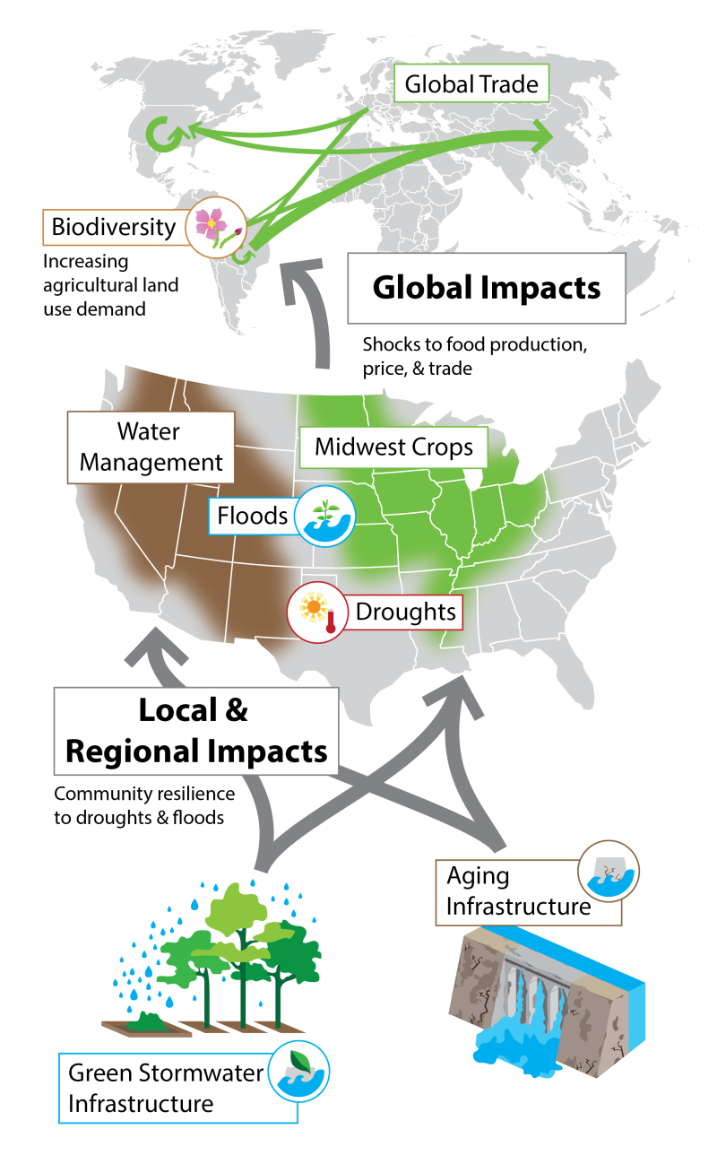
“You need to engage all these different domains and experts to act on the same page to assess what is at stake for solving this very societally relevant problem," says Wang.
The use of AI to synthesize spatial data also presents opportunities and challenges, along with the creation of digital twins — computer models of real-world systems that are so powerful that they can be used to mimic and predict real-world scenarios. Data sharing and access are also important issues — democratizing the benefits of GIS.
"Artificial intelligence is vastly disrupting the educational system and also the research world," says Goodchild. "We've started using AI for prediction. We're also using AI for spatial search."
Whatever comes out of these new developments, GIS has already come a long way, from spatial data handling to a vibrant field of science that forms the basis for integrative approaches to help address some of the most critical issues in modern society.
Hear more from Jack Dangermond on the history and potential of GIS.