Better coordination networks to strengthen interdependent infrastructure resilience
After hurricanes Harvey and Irma, the National Science Foundation (NSF) funded research to investigate the broad impacts of these disasters. A year later, some of the researchers funded by awards from the agency's Social, Behavioral, and Economic Sciences Directorate are reporting results produced to date. This is the fourth article in the series. Ali Mostafavi, an assistant professor of engineering at Texas A&M University, studies the role of planning processes across sectors to understand why and how Houston experienced infrastructure failures after Hurricane Harvey.
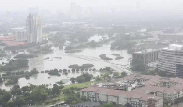
We wanted to understand why Hurricane Harvey caused such tremendous infrastructure failures and disruptions in the city of Houston and Harris County. We used a combination of surveys, field visits and network analysis to assess the relationships and interdependencies between key stakeholders and decision-makers, existing infrastructure and resilience plans, and the physical infrastructure itself. We looked at the structure and properties of flood control and road infrastructure networks and specific points of failure and then tried to understand the causes of vulnerability and failures.
There are four main takeaways from this analysis so far:
- Collaboration between stakeholders (policymakers and decision-makers across sectors, state and local government and non-governmental organizations) was fragmented, with silos that negatively affect resilience and hazard mitigation planning.
- Partially because of this fragmentation, network plans were not developed in concert. For example, the transportation plan had as a goal to relieve traffic, so the city of Houston built a new highway. Transportation planners weren't thinking about flood risk in the area. When housing plans allowed developments to follow the highway, flood risk wasn't considered, even though the new developments were between two reservoirs and covered green space with concrete.
- The dependencies of one infrastructure system on another are not fully accounted for. For example, civil engineers design street drainage of heavy rains and flooding to minimize the damage to buildings. Emergency response systems didn't take this planned street flooding into account, making it much harder than expected to reach people in need.
- Most of the plans in place were built around the needs of the community as a whole, with a lack of focus on vulnerable populations that sometimes had specific needs. The most vulnerable populations will need the most resources in a recovery, and they are also very often the same populations left out of the planning process. There needs to be more thinking at the policy level about the most vulnerable.
We are incorporating these takeaways and more into two tools we are building for policymakers and engineers so that they can improve their planning processes. The first is a computational model of infrastructure that will allow new developments and infrastructure retrofits to be assessed for enhanced resilience. The second is a scorecard that will allow the evaluation of how well integrated community plans are for all hazards, flood control and mitigation; emergency response; etc. to achieve local and regional resilience to flooding and other disasters.
The project as a whole is doing more than collecting data to be put in a model. It is actually fostering community engagement and communications across sectors. We aren't just saying, "You all should collaborate more for resilience planning." We are building the actionable science, tools and networks needed to implement this collaboration.
