Storm-chasing, winter style: Atmospheric scientist follows the snow
Jim Steenburgh isn’t your typical storm-chaser. The atmospheric scientist isn’t after Midwest tornadoes nor supercell thunderstorms.
Steenburgh chases snowstorms.
Peering inside a snowstorm
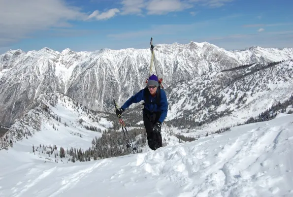
Growing up in the Adirondack Mountains of upstate New York, he remembers always watching for snow. As a snow scientist at the University of Utah and an avid Alpine, Nordic, and backcountry skier, Steenburgh continues that quest today.
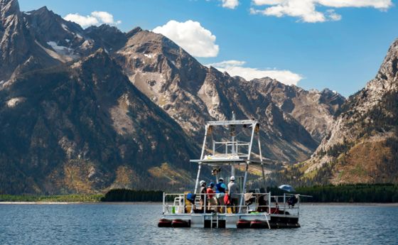
Steenburgh and other NSF-funded principal investigators led the Ontario Winter Lake-effect Systems project. Using ground-based and airborne instruments, including Dopplers on Wheels, the University of Wyoming’s King Air Research Aircraft, mobile weather balloons, and snowfall measurement systems, they probed the inner workings of blizzards around Lake Ontario.
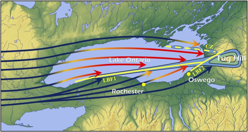
Of particular interest, Steenburgh says, are the processes responsible for snowfall enhancement over New York’s Tug Hill Plateau, which rises about 2,000 feet above the eastern shore of Lake Ontario and sees some of the most intense snowstorms on Earth.
“Researchers hit the motherlode of data,” says the atmospheric scientist. During one three-week stretch, the team measured 100 inches of snow on the Tug Hill Plateau, including three storms in which peak snowfall rates reached 4 inches per hour -- and one storm that produced 40 inches in 24 hours.
Project investigators combed through reams of data and used computer modeling to uncover the inner workings of these storms. Although cold-air outbreaks over warm waterbodies are a critical ingredient for lake-effect storms, “the devil is in the details,” Steenburgh says.
The scientists found that subtle variations in the Lake Ontario shoreline play an important role. A bulge on the lake’s southern shore contributes to formation of an air mass boundary that extends downstream and serves as a generator for lake-effect snow. Another bulge at the eastern end of the lake produces a second airmass boundary that contributes to snowfall over the Tug Hill Plateau.
Greatest snow climate on Earth
During the analysis, lake-effect snow in another region began to attract Steenburgh’s attention. In this case, the “lake” is the Sea of Japan, also known as the East Sea, between mainland Asia and the Japanese islands of Honshu and Hokkaido.
“Utah may be famous for the ‘Greatest Snow on Earth,’” Steenburgh says, “but Japan has the ‘Greatest Snow Climate on Earth.’”
In winter, frequent cold-air outbreaks from interior Asia move over the Sea of Japan, a body of water more than 50 times larger in area than Lake Ontario. The resulting sea-effect storms run into the mountains of Honshu and Hokkaido, which are much higher than the hills and plateaus around the Great Lakes, leading to frequent and prolific snowfall.
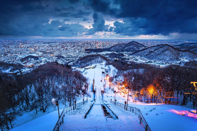
Densely populated Sapporo on the west coast of Hokkaido is the snowiest city in the world with more than 1 million people, averaging 235 inches of snow a year, according to Steenburgh. Mean annual snowfall in the mountains adjacent to the Sea of Japan exceeds 500 inches, with the mean annual snowfall at Sukayu Onsen hot spring in the mountains of northern Honshu reaching 694 inches.
“People are often surprised to hear it snows so much in Japan, but the climate and geography of the region are ideal for producing huge snowfalls,” says Steenburgh. “When exceptionally cold air from interior Asia moves over the Sea of Japan, watch out. The heavy snow region near the Sea of Japan, known as the ‘Gosetsu Chitai,’ has seen many snow disasters.”
Sea-effect vs. lake-effect storms
Steenburgh and University of Utah researcher Peter Veals traveled to Japan’s Nagaoka Snow and Ice Research Center to collaborate with scientists Sento Nakai and Satoru Yamaguchi. The team is working to increase knowledge of how lake- and sea-effect storms interact with downstream topography.
The project has revealed the factors that control the locations of heaviest snowfall during sea-effect storms, including the mechanisms that lead to “yamayuki” storms which produce deep mountain snow and “satoyuki” storms, with their heavy lowland snowfall.
“These findings are also important for understanding snowstorms elsewhere in the world, including the Tug Hill Plateau and hills and upland regions around the Great Lakes,” says Steenburgh.
Lake- and sea-effect snowstorms have direct effects on society, he says, from the rural communities on the Tug Hill Plateau to the major cities of western Japan. They also stimulate a vibrant winter-sports economy based on activities such as snowmobiling, skiing and snowboarding.
“Predicting high-impact snowstorms is a scientific challenge,” says Jielun Sun, a program director in NSF’s Division of Atmospheric and Geospace Sciences. “Rapid development of heavy snowstorms, especially over densely populated cities, can be a transportation nightmare.
“These studies of the interplay between lakes/seas and their surrounding hills/mountains and how that relates to snowstorm development are important for improving our understanding of snow distribution and intensity downstream of a waterbody, leading to better snowstorm forecasts.”
Who you gonna call to avoid, or find, deep powder? With his record of facing down Old Man Winter’s white-out blizzards -- and locating champagne powder, as skiers refer to light, dry snow -- Jim Steenburgh should be at the top of your list.
Want to learn more about snow? Steenburgh's Wasatch Weather Weenies blog discusses the weather and climate of the Wasatch Front and Mountains, western U.S., and beyond. Many posts feature content or insights enabled by the support of the NSF.
Map citation: Steenburgh, W. J., & Campbell, L. S. (2017). The OWLeS IOP2b Lake-Effect Snowstorm: Shoreline Geometry and the Mesoscale Forcing of Precipitation, Monthly Weather Review, 145(7), 2421-2436. Retrieved Jan 21, 2021, from https://journals.ametsoc.org/view/journals/mwre/145/7/mwr-d-16-0460.1.xml


